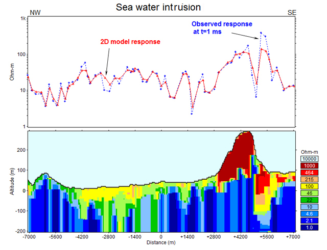
| Mapping of sea water intrusion into the coastal zone of Crete Island. Low resistivity at altitudes less than MSL (Mean Sea Level) indicates highly mineralized intrusion waters.
The objective of the research is mapping of zones dangerous for drilling of wells for irrigation, because these zones can be salted immediately or after some operation time. |
